
Are you tired of always doing the same on vacations? Hot-...
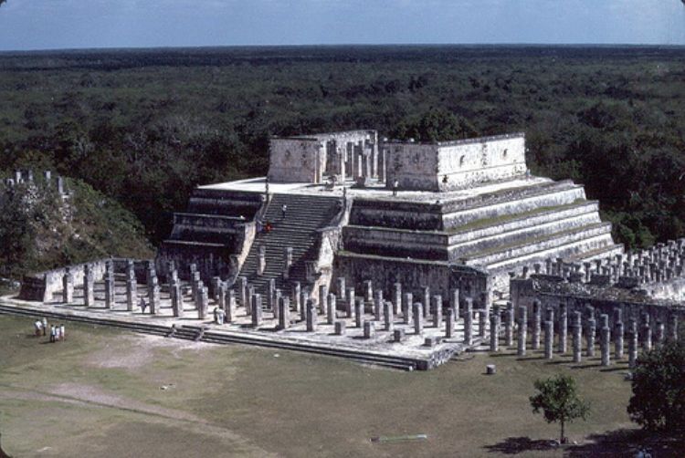
Yucatán has a territorial extensión of 39,612 km2, and 2% of the Mexican surface. The state of Yucatan attaches to the Gulf of Mexico on the North and best, on the east with Quintana Roo, and south with Campeche.
The vegetation is classified as middle and low tropical. The most representative species are henequen, caoba, cedar and caiba.
Yucatan lacks rivers and creeks, which makes its hydrology subterrain (cenotes and lakes).
The predominating climate is hot and subsumid; the average temperature is 78, 80ºF and the rainy season is June-July.
This region lacks in elevated zones, it mainly has rocky territory and deep ditches. These ditches that accumulate rain, originated in the coast of Yucatan. The humidity that comes from the accumulation of this water is important to the fishing activity and to maintain equilibrium for all the ecosystems in the surrounding areas.
The most representative fauna is the pink flamingo, jaguar, Carey turtle, and quail of Yucatan, tepexcuintle, duck, and tapir.
Are you tired of always doing the same on vacations? Hot-...
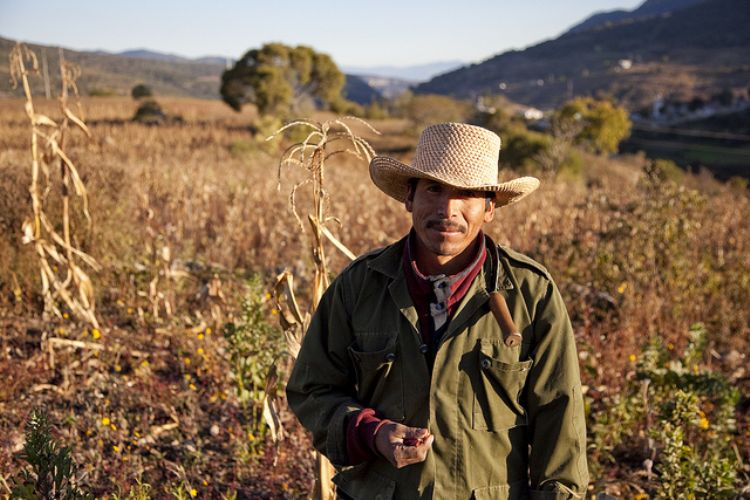
Even though agriculture in Mexico occupies a minor role i...
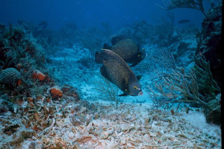
The Great Mayan Reef, also called Mesoamerican Barrier Re...
Mexicoâs War of Reform, also known as the Three Year Wa...
After Mexicoâs Independence, the country was in a const...
The Southeast region of Mexico includes eight States: Gue...

In the prehispanic world, the concept of death played a f...

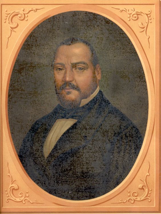
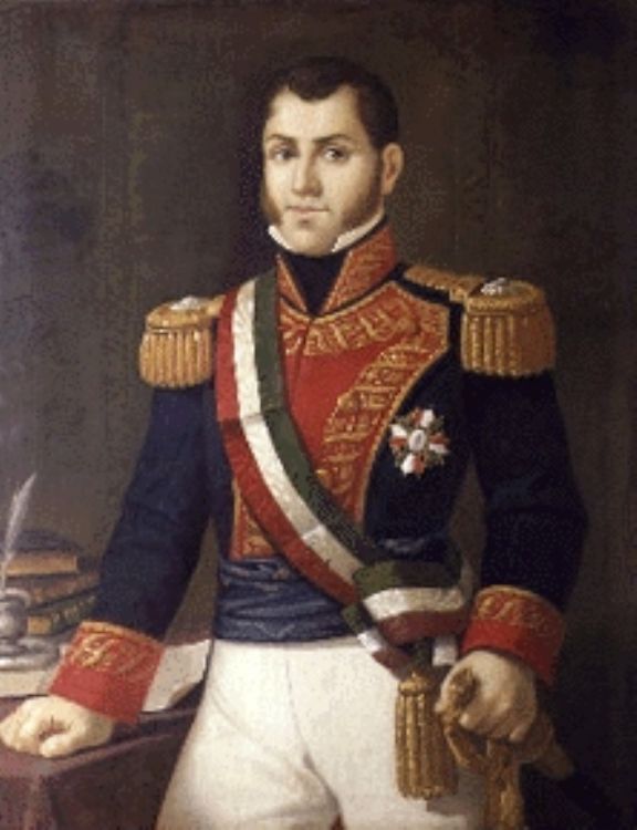
Without a doubt, this politician is also a character: No ...

The Voterâs Mexican Credential or Federal Elect...

Pozole is a delicious dish prepared with corn, meat, pepp...
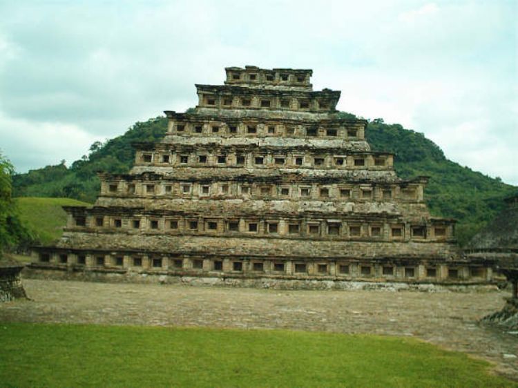
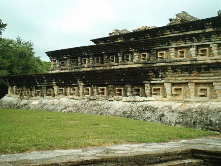
The most accepted interpretations state that the name Taj...

Rodolfo Morales; He was born in 1925 in Ocotlán de...