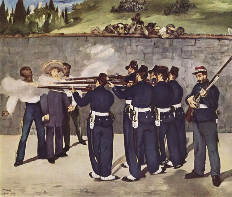
The French intervention of Mexico by the army of the Seco...
Tamaulipas is the sixth larger state in Mexico with a territory that extends throughout 80,175 sq. kilometers. Located northeast of the federation, it shares its borders with the Gulf of Mexico to the east, the United States to the north, and the neighboring states of Veracruz and San Luis Potosi to the south, and Nuevo Leon to the west. The geographic imaginary line known as the Tropic of Cancer crosses the northern part of the capital city of Ciudad Victoria.
The coastal plains along the Gulf have a large presence in the state, whereas in-land the landscape is adorned by cactus species and pasturelands. Predominant fauna in the region include the puma, mountain lion, weasel, ocelot, badger, beaver, quail, and a type of guan called chachalaca.
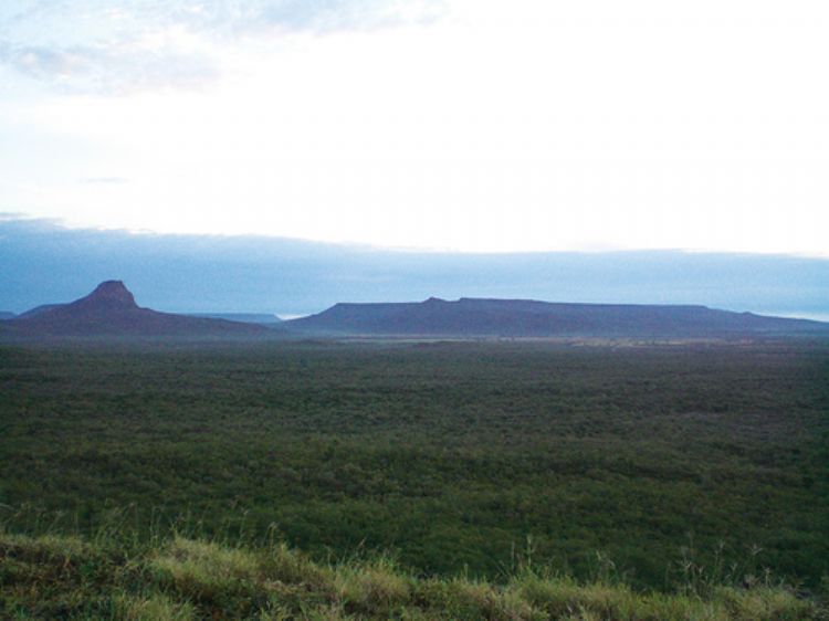
In the southeast, the eastern Sierra Madre displays warm valleys and high sierras with peaks reaching 3,280 meters in the Pedragoso Sierra; 3,240 in the Borregos Sierra; 3,220 in La Gloria Sierra; 3,180 in Cerro el Nacimiento; and 3,000 meters above sea level in the Sierra el Pinal.
In terms of hydrology, the Bravo, Purificacion and Guayalejo rivers flow into the Gulf of Mexico after crossing the state from the western inland. On their way, their basins and zones of influence naturally correspond to the areas destined for agricultural use. The Rio Bravo, preferably known in Mexico as the Rio Grande, represents the northern frontier shared with the United States. One of the tributaries of this natural border, the San Juan River, feeds the Falcon International Reservoir and the Marte Gomez Dam, which, in conjunction with the "Friendship Dam", reach a capacity of 12,940 million cubic meters of stored water. The agricultural and cattle raising activities are served by other 14 dams across the state, with a total capacity of 7,500 million cubic meters of water.
As much as 90% of the state reports a dry or semi-dry climate, while the Huasteca mountain range presents hot and semi-humid conditions, along with humid winds coming from the Gulf, which means it is located in a zone highly influenced by cyclones, with predominant winds coming from the east and southeast.
The French intervention of Mexico by the army of the Seco...

The son of diplomatic parents, Carlos Fuentes was born in...
Europe became very interested after the discovery of Amer...

The Bank of Mexico is the central bank of Mexico and was ...
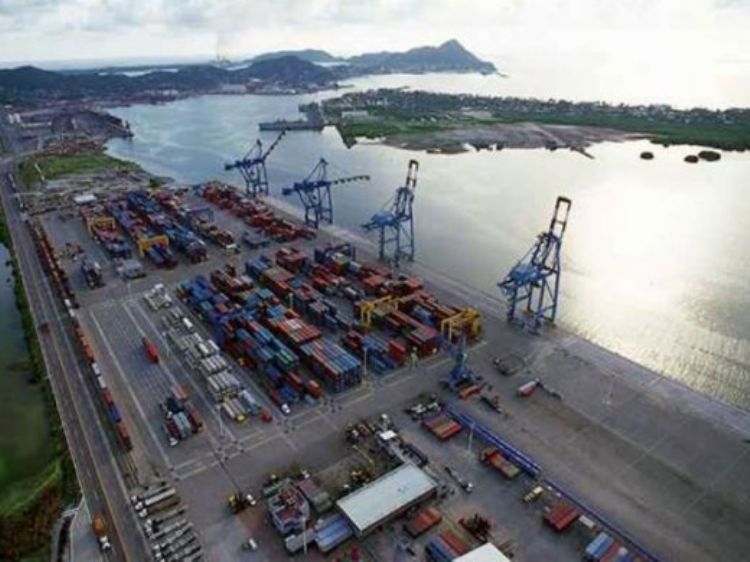
Port of Ensenada; This port is located on Mexicoâs nort...
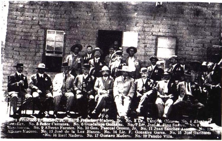
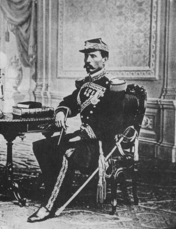
During the 19th century, the country had many battles, no...

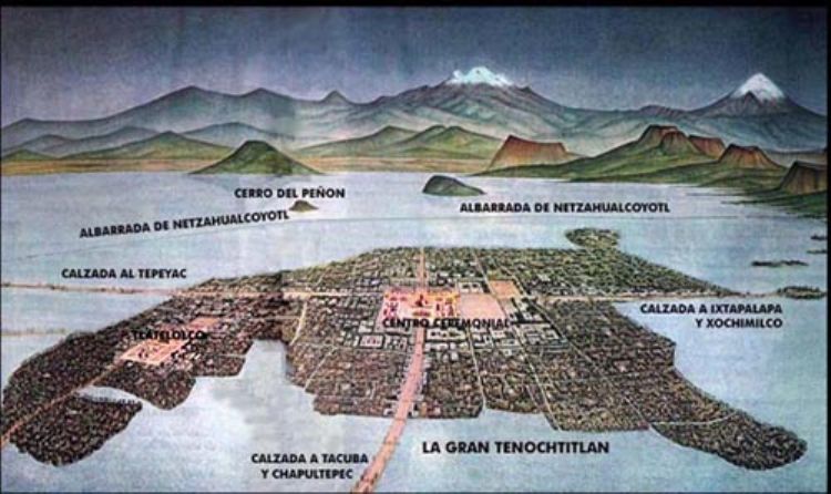
It is a combination of natural formations and those contr...

Agriculture is still one of the most important activities...